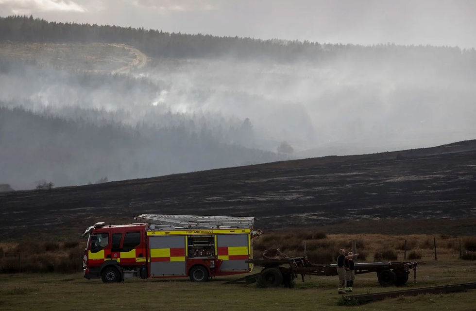
Rewilding Britain's Wildfire Report: Six Questions About the Evidence


Quick summary
Rewilding Britain's report says rewilding cuts wildfire risk, but its project analysis lacks a baseline of managed sites.
The report measures neither fuel loads nor fire severity, and does not separate young from mature restoration.
Its four UK upland peat examples rest on web pages and press releases, not peer-reviewed site studies.
Peat recovery takes decades, so recovering moors will need their fuel loads managed in the meantime.
Rewilding Britain's new report argues that rewilding makes landscapes more resilient to wildfire, and that burning, grazing and drainage keep the uplands at high risk. We checked its figures, methods and sources.
What the report says
The report matches satellite maps of burnt ground against land-cover data. It finds that acid grassland, heather and bog make up most of the burnt area, and deciduous woodland just 0.5%.
It reports that only one of 285 Rewilding Network projects was affected by wildfire between March and August 2026. It calls for rewetting, habitat mosaics, natural grazing and long-term funding.
Where we agree
People start most wildfires (the report cites 77%), so prevention and public education come first, as the report accepts.
The threat is growing; the report cites the Moorland Association's estimate of up to £460 million in wildfire costs in 2025. We agree that wetter peatland is harder to burn, and that grazing can break up fuel.
Questions the report needs to answer
How many projects were in the path of fire?
The report says "it is estimated that only one project was directly affected by wildfire". It does not say how many projects lie in the uplands, on peat or near 2026 burns. Each project was treated as a single point with a three-mile buffer, and "directly affected" is not defined.
Were comparable managed sites examined?
There is no equivalent figure for managed moorland, farmland or random points. The Rewilding Network covers about 1% of Britain. Without a baseline, a low count may reflect where the projects are.
How were fuel loads and fire severity measured?
Its own analysis measures neither. Burnt area comes from EFFIS, the EU's wildfire monitoring service, which mainly maps fires of about 30 hectares or more, so smaller fires may not register. Severity enters only through a cited study, Lees et al. 2026.
Does the report separate mature from young restoration?
The project analysis records neither age nor restoration stage, yet the report warns that early transition can raise fuel loads. Its Troedrhiwdrain example, rewetted 18 months before the fire, reports damp peat but no vegetation or fuel data.
What is the evidence for British upland peat?
The report offers four UK upland peat fire examples: Elan Valley, Troedrhiwdrain, Rumster Forest and Tywi Forest. None is a peer-reviewed site study: the sources are an air-quality company's news page, a farming network web page, a NatureScot case study and a Natural Resources Wales press release.
Eight more are overseas, and three UK examples measure flooding or water storage, not fire. The report gives no management history for the Elan Valley's 8,000 burnt hectares.
Can land-cover maps show land management?
The report's 2023 land cover map records vegetation type, not burning, grazing or drainage. Even so, the report attributes heather fires to grouse moor management. Nor are habitat burn shares compared with each habitat's extent, so a widespread habitat ranks high whether or not it burns readily.
The 64% "monoculture-dominated" headline counts fires where one land-cover class covers at least 75% of the scar. It does not identify plantations or grouse moors. Its "up to 80% of uplands degraded" graphic cites a source about UK peatlands.
What the evidence says about managing fuel
The report accepts that burning and grazing "have resulted in a reduction in vegetation fuel loads in the short term". On one study moor, burning rotations under 20 years kept above-ground biomass and vegetation height below that of stands unburnt for over 50 years.
In July 2026 Natural England told MPs that land management can help reduce the risk and severity of fires. Defra's rules still allow burning to reduce wildfire impact where peat is under 30cm deep.
For its claim that repeated burning encourages heather, the report cites a research-priorities paper, not field results. A long-term experiment on degraded northern English blanket bog found the opposite: burning reduced heather and increased cotton-grass and Sphagnum.
Moisture strongly affects how severely fuel burns. In Scottish experimental fires, simulated drought raised peak soil-surface temperatures on dry heath from 31°C to 189°C, but only from 10°C to 15°C on a saturated raised bog.
Degraded peat does not reach that state quickly. In Wales, water tables recovered very gradually after drain blocking, varying between catchments. Once raised, they held steadier through dry spells.
On restored bare peat in the south Pennines, plant cover returned within two years, but water tables rose only gradually over 15 years of monitoring. A source the report itself cites says peatland recovery takes decades.
Damp ground 18 months after rewetting is a good start, but a mature, Sphagnum-rich bog that resists fire through a long drought takes longer. Until then, the report's own advice applies: mown firebreaks and grazing buffers to bridge the gap. That is active fuel management, and recovering moors will need it for years.
Why this matters
Land managers and upland communities need wildfire policy built on fair comparisons, so that rewetting and fuel management are each used where, and for as long as, the evidence shows they work.