Heather Management Spared an Estimated 7,000 Tonnes of Carbon at Langdale Moor


Quick summary
Langdale Moor's 2025 fire released about 25,000 tonnes of soil carbon, England's largest recorded wildfire peat loss.
Heather patches managed within a year of the fire showed no high-severity burning at all.
Researchers estimate management spared close to 7,000 tonnes of carbon.
About 25,000 tonnes of soil carbon left Langdale Moor for the atmosphere last August. Close to 7,000 tonnes did not, and a new study, awaiting peer review, puts that down to patches of heather that had been managed in the years before the fire reached them.
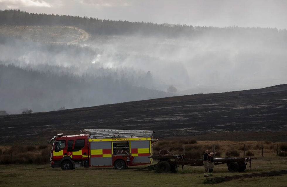
The fire ran for more than six weeks across 1,239 hectares of the North York Moors. It burned deep enough into the peat to detonate over twenty devices left from the site's years as a military training area, which made suppression slow and dangerous.
Researchers from Swansea, Exeter and Birmingham walked the burnt ground three weeks after the fire started, measuring how deep it had burned. Their figure for peat soil carbon lost is the largest recorded in England for a single wildfire.
Inside the burnt area, the managed patches behaved differently. Of ground treated in the twelve months before the fire, 77% was unburned or burned at low severity. None of it burned at high severity.
Taking all managed patches together, severity was lower than in the surrounding ground to a level that was statistically significant, with a median score in the low band against moderate outside.
How the 7,000 Tonnes Was Calculated
About 110 hectares of peat inside the fire perimeter came through unburned, on ground the authors identify as recently managed.
To put a carbon figure on it, they apply the rate measured on the moor's worst-hit ground: 6.02 kilograms of carbon per square metre, from areas where peat burned to a mean depth of 13 centimetres. Across 110 hectares, that comes to 6,756 tonnes.
Where the Carbon Went
A separate figure, and one worth not confusing with the last: peat loss was concentrated. Just 115 of the 1,210 hectares of peat inside the fire perimeter burned at high severity, and that ground alone gave up 6,931 tonnes of carbon, more than a quarter of the total.
The 743 hectares of moderate severity contributed the remaining 18,254 tonnes. Low severity ground lost no peat at all, with damage stopping at the vegetation.
Depths tell the same story. High-severity ground had lost 13 centimetres of peat on average and up to 20 centimetres, much of it reduced to mineral ash with no char left in it. Moderate ground lost around 5 centimetres.
For comparison, the worst of Saddleworth Moor in 2018 averaged 6 to 7 centimetres, and Scotland's Dava Moor fire last year reached about 10. Only the 2019 Flow Country fire went deeper.
Dava burned more than 10,000 hectares to Langdale's 1,239 and lost more carbon in total. Per square metre of ground burned, Langdale lost roughly six times as much: 2.03 kilograms against 0.32. Area burned is a poor guide to how much damage was done.
What the Transect Found
Most of the managed patches inspected on the ground showed short charred stems standing among green regrowth, which is prescribed fire. One patch had been cut instead, with the brash left where it fell. That brash was actively smouldering when the team walked past it.
That is one observation, not a trial. It does not establish that burning outperforms cutting. It does line up with a mechanism every keeper already works around, which is that a continuous litter layer gives fire a path to keep moving and keep driving heat down into the peat.
Why This Matters for Upland Policy
More than half the Langdale burn, 52.6%, ran over peat shallower than 30 centimetres.
Where the peat is shallow, the water table sits shallow too, and in an August that ran 1.6 times drier than the 10-year average for the site, there was little left underneath to protect the surface.
The Moorland Association's position is that fuel structure is the one variable managers can change inside a single season, and that policy on rotational burning over peat should be tested against fire-severity evidence rather than settled ahead of it.
Langdale does not settle anything on its own. It is one fire, measured after the event, with no controls. What it does provide is a rare thing in this argument: a mosaic that was already on the ground when a severe drought fire arrived, with a measurable difference between the treated ground and the rest.
That mosaic existed because someone made it in advance, on a moor that had no reason in 2019 to expect August 2025. The managers who cut and burned those patches were doing the only work available to them that changed the outcome.