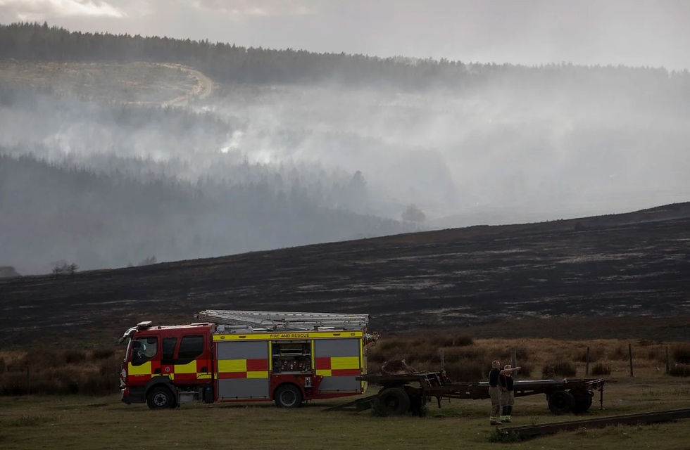
The Fuel Was on the Ground: Reading the Fylingdales Moor Fire Report


✅ Key Takeaway: A naked flame on a parched moor caused the North York Moors' largest recorded wildfire, burning around 1,400 hectares of peat and exposing the lack of a national wildfire plan.
A naked flame used for cooking, on a moor left tinder-dry by record drought, started the largest wildfire in the North York Moors' recorded history.
The Fylingdales Moor fire of summer 2025 burned across roughly 20 square kilometres, the most extensive wildfire ever recorded in North Yorkshire, and is now set out in a multi-agency report from the North Yorkshire Local Resilience Forum (NYLRF).
For anyone managing upland ground, it is a close account of how fast a moor burns when the fuel and the weather line up.
Record Heat, Drought and Available Fuel
The Met Office recorded spring 2025 as the warmest and sunniest on record, followed by the hottest summer. North Yorkshire was in prolonged drought, and a Yorkshire hosepipe ban had been in force since 11 July.
The report records the likely cause as cooking with a naked flame, a campfire or gas burner, and states plainly that combustible material was present on the moor and helped the fire take hold.
That detail matters. The report's own assessment is that the fire ran predominantly through surface vegetation and peat, with limited complete combustion of standing trees. The fuel that carried this fire was the ground itself.
Why the Fire Was So Hard to Fight
Fire was first reported in Langdale Forest, beside the moor, on 26 June. It was contained and handed to Forestry England, but the report treats the major August fire as a continuation of the same incident.
A Major Incident was declared on 13 August after unexploded munitions began detonating in the heat and the response had to protect RAF Fylingdales, a site of national security importance.
Those detonations, more than 20 of them and known as cook-offs, came from the moor's past as a wartime training range. They forced crews to fight from the perimeter rather than attack the fire directly.
On 25 August a wind shift pushed the fire through a northern firebreak and north across the moor, forcing the evacuation of caravan parks and the closure of the A171 and B1416. The coordinated response stood down on 5 September. No lives were lost and no buildings were destroyed.
Deep Peat, Lost Habitat and a Heavy Carbon Cost
Around 1,400 hectares of blanket bog and moorland habitat burned, including an estimated 920 hectares of Atlantic wet heath and 300 hectares of dry heath. The report states that the loss of peat soils will permanently change parts of the moor's vegetation and character.
The carbon cost is heavy. Initial analysis by the University of Exeter, which the report flags as a preliminary estimate extrapolated from a sample of the burn, puts direct peat combustion at about 54,000 tonnes of carbon dioxide equivalent.
The burn area supports protected species including goshawk, merlin, adder, common lizard and water vole, and 13 Scheduled Monuments are now considered at risk from the fire and the erosion that follows it.
The Cost to Farms and Rural Businesses
The report is direct about who paid. Landowners, common graziers and farmers lost grassland for livestock, faced access restrictions and evacuation, and carried uninsurable business interruption.
Fire destroyed sections of livestock fencing across the moor, and reopened roads needed wild-animal warning signs because stock could now stray onto carriageways.
Those same farmers were part of the response. The report records that firefighting by the fire service, partner agencies and responding farmers removed the need to put pre-prepared evacuation plans for seven further settlements into action.
Weeks of Smoke
The smoke plume hung over coastal communities for weeks and the report notes that vulnerable residents, including children, older people and those with existing conditions, will have felt acute effects.
A Preparedness Gap the Report Will Not Ignore
The report makes one comparison hard to miss. Flooding has nationally agreed response arrangements; wildfire has none. It recommends that a national wildfire framework be developed, and states that the partnership has a role in advocating for prevention.
This is an interim report covering the response phase only, and a second report on recovery and the longer-term cost of moorland restoration is due in 2026.
The lesson of the first is already on the page: the fuel was on the ground, record drought did the rest, and the country still has no agreed plan for the next fire of this size.